The term “spatial data” is used to describe any data related to or containing information about specific locations on the earth’s surface. Hence, many of the field data you collected can be considered as spatial field data. Spatial field data collection involves collecting three types of features, namely points, lines, and polygons.
- Point–Sample Location, Tree, Bench, Bus Stop, Street Sign, or City (no length or area)
- Line–Sample Transect, Road, Bus Route, Stream, or Utility line(no area)
- Polygon–Sample Plot, Parking Lot, Vegetation Patch, Building Outline, or Political Boundary
The spatial data collection involves many types of devices depending on the level of accuracy of the data required in your analysis. And also, the data you collected is not limited to the spatial features mentioned above, you may be required to collect many attributes data related to those features. The conventional field data collection involves lots of paper works. Hence, it requires spending more money and time on data entering and validation.
However, with the advancement of mobile devices, spatial field data collection has become easier than ever. You can build data collection apps using many types of sensors such as GPS, Magnetic (Compass), Camera, Gyro, etc… built into your smart devices for tracking location data. You can include fields as many as you required for collecting attribute data.
For example, if you want to mark your customer locations, you can create a mobile app and create a form to fill your customer details like name, email, physical address, phone number, etc. You can build your app to get the device location at the time you click the submit button. Then you can install this app on your salesperson’s smartphone and as send him to the customer’s location to collect the data.
Table of Contents
Do I need to create a Mobile App from scratch?
Creating a mobile app from scratch involves a high cost and time. Unless data collection is a part of your organization’s routine task, creating a mobile app from scratch is not a viable solution.
A few years back, building a mobile app was beyond the skills of many professionals, and it was a costly solution. However, if you just Google for “no-code mobile app builders” you will get several online platforms where you can build your data collection apps online without any knowledge of coding. You can build mobile apps with these platforms within a short period of time. Some services, allow you to convert a Google Sheet data table to a mobile app and save the data to the Google Sheet and upload the files to Google Drive. Each of these services has different pricing models, many of them have per month per user rental.
In this post, I will discuss one such solution I already tested and used for a spatial data collection project.
In this post, I will discuss Mobile Data Collection (MDC) a product of GIS Cloud, which is also I successfully used in some of my spatial field data collection projects.
What is GIS Cloud

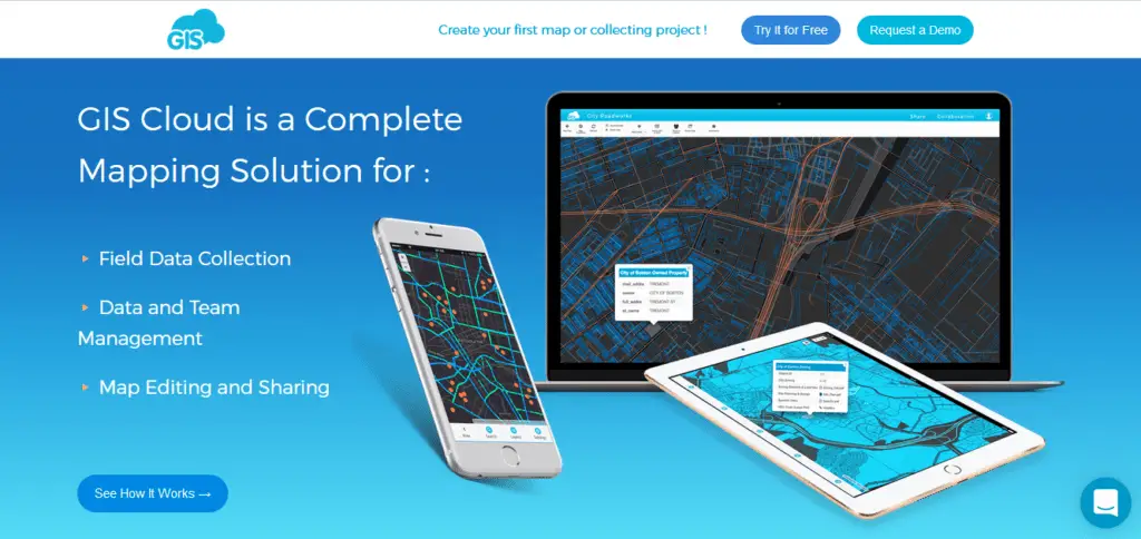
In short, Gis Cloud is a complete cloud-based mapping solution for Field Data Collection, Data and Team Management, Map Editing and Sharing.

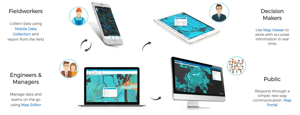
The GIS Cloud comes with the following products for collecting and sharing of your field data.
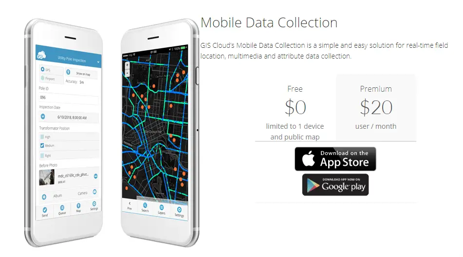
Mobile Data Collection (MDC): With MDC, you can easily collect, inspect and update data in the field using your own custom forms. You can collect points, lines, and polygons and access your map online and offline.
Map Editor: With Map Editor, you can upload your vector & raster datasets or publish data from your desktop tools. And also it allows you to create, style, edit maps and share projects and invite your coworkers to join you.
Map Viewer: With Map Viewer, you can access private maps shared with you, anytime, anywhere, online & offline.
Map Portal: With Map Portal, you can make your maps publicly available through a simple and intuitive interface.
Spatial Field Data Collection with GIS Cloud Mobile Data Collection (MDC) tool
GIS Cloud Mobile Data Collection is a tool for web and mobile devices that allows you to collect data in real-time, with custom-designed forms, work in offline mode and more. Collect field data and conduct field surveys faster and easier than ever before.
Benefits of using MDC
- No paper works
- No data entry – This significantly reduces both cost and time of data collection.
- Reduce errors significantly – Data entered the system only once, and everyone uses the same data. Therefore it reduces human errors significantly.
- Data Validation on the Field – Data validation will ensure correct data entry in relevant fields and completeness of the data. Reduce the % of invalid data.
- Analyze data in real time – Managers can analyze data in real time while the survey is ongoing.
- Remote monitoring- Managers can deploy the enumerator and monitor their performance remotely.
- Support Multimedia Inputs – MDC support not only text. It supports other formats like images, video recording, and voice recording.
- Increase reliability – Many input types, validations, timestamps, and GPS coordinates increase the reliability of your data set.
- Conditional questions – With conditional questions, you can skip or enable some other questions based on the answers given. With this, you can eliminate increasing the length of the form unnecessarily.
These are the common benefits of using the MDC spatial field data collection. However, you will find it is more useful depending on the nature of your data collection project. In terms of cost, MDC will reduce the cost of data collection, by at least 70-80% compared to traditional data collection methods. In other words, GIS Cloud MDC can greatly improve the productivity of your work.
Start with 30-day Free Trial
You can create and test your project completed with the free trial. The free account is limited to 10,000 vector features and 100MB of storage. Follow the steps below to create your first Mobile Data Collection project with GIS Cloud and start collecting your spatial field data.
- Create a GIS Cloud account from here.
- Log in to the account and create a new project (Watch the video below).
- Install the mobile app from the following links.
- For Android
- For iOS
- Log in to the mobile app using the same credential.
- Select the project on the settings page of the mobile app. Click the Form button at the bottom left corner of the app.
- Fill out the form and click send. (If you are connected through WiFi, your data will be uploaded to the server in a few seconds. To upload with cellular data allow “sending using the cellular data network” at the settings page)
- Then you can view your uploaded data in the web portal at mdc.giscloud.com.
Alternatively, you can watch the following video for getting started with Mobile Data Collection.
You can create gis cloud accounts for your staff with the manager (manager.giscloud.com) account and share your project with them. However, you need to have paid licenses to allow them to upload data with the MDC mobile app.
Purchase Licenses and assign them to users

When your app is ready to deploy, you need to purchase the required number of licenses to enable your team members to send and update data with their accounts and increase the account limits. To purchase and assign licenses;
- Go to the Manager app at manager.giscloud.com
- Go to the Store tab. From here, you can purchase the required licenses for each of their products. In this case, you need to purchase a Mobile Data Collection license.
- Once you purchase a license, you need to assign those licenses to yourself first (Watch the video below).
- Then you can go to the MDC app (mdc.giscloud.com) and share the project and allow your team members to submit data (Watch the video below).
The following video explains how to purchase and assign licenses for Mobile Data Collection.
View Data
You can view the data with the MDC web portal (mdc.giscloud.com) in real-time. If you go to the Map tab, you can see both the data table and the map together. Once you click on the data, the map will zoom in to the relevant location and open up the info window.
You can use these, data with all the other GIS Cloud Products. For example, you can use the layers created with MDC with Map Editor and create maps.
Export Data
You can export data in CSV format. If your data collection includes images, you can generate an HTML report and save it as a webpage, and then your images will be downloaded to a separate folder with the same name in the image column of the CSV file.
Learn More about GIS Cloud
In this post, I gave you a brief introduction to the GIS Cloud Mobile Data Collection tool. As mentioned in the beginning, GIS Cloud has several products that can give you a complete solution for projects. You can learn everything about their product from their user manual. I found it is somewhat easy to follow the user manual, and it includes some images and videos to explain things better.
You can also learn more about GIS Clouds updates, case studies, and examples, etc… from their Blog.
